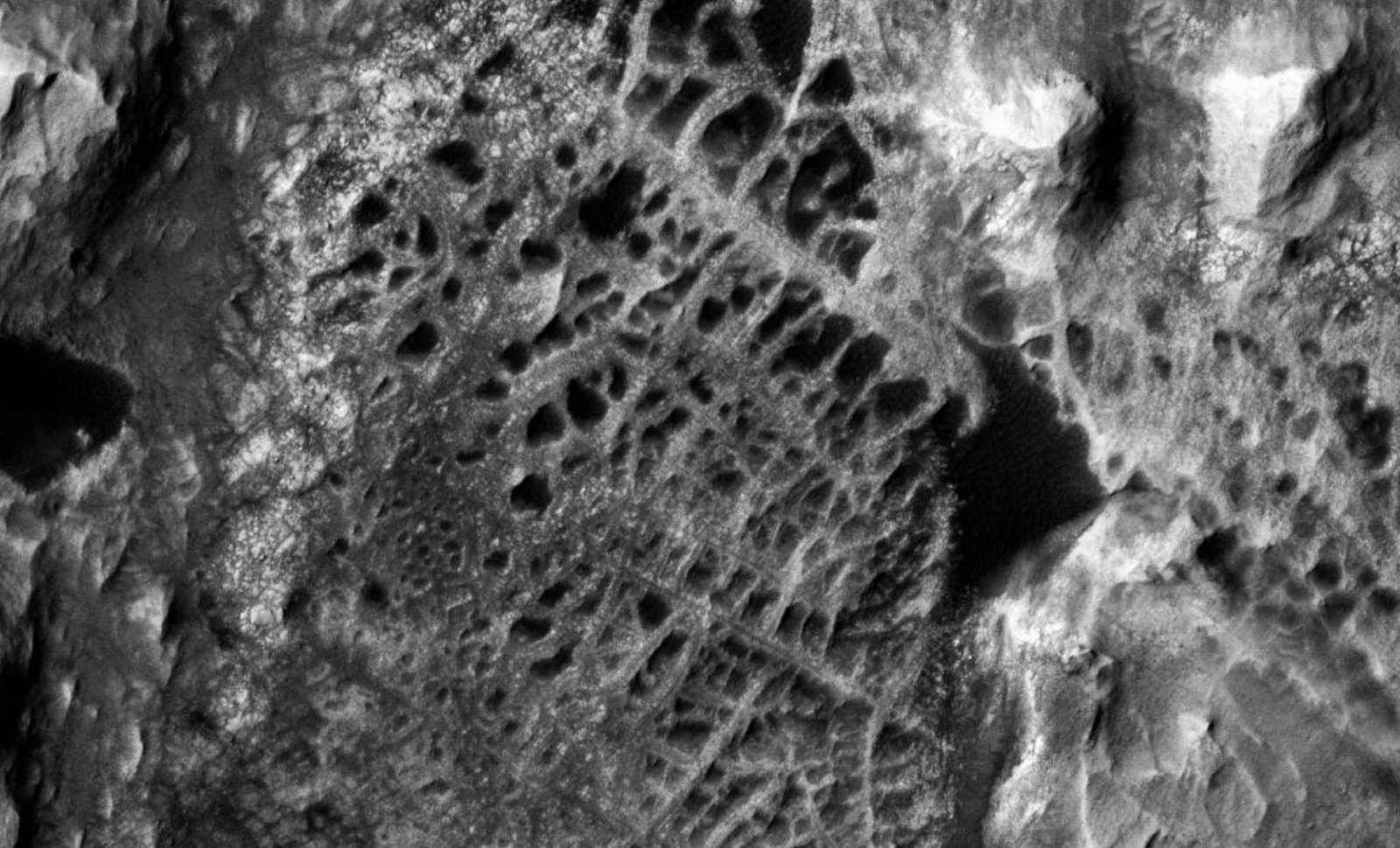
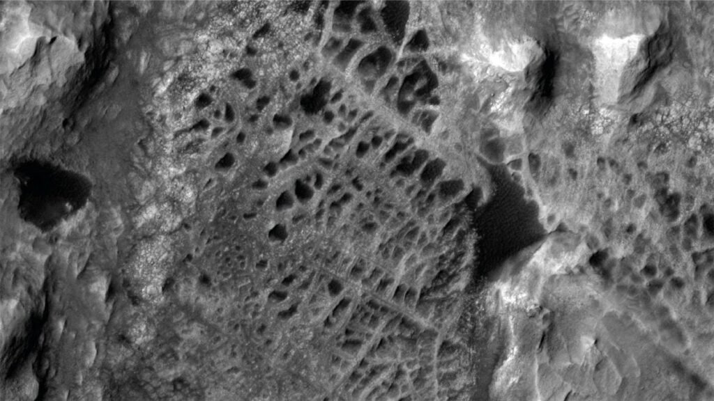
NASA’s Curiosity rover has arrived at a geologically intriguing site on Mars, where it encountered a dense network of intersecting ridges that may represent a rare structure known as boxwork. Captured first from orbit and now viewed up close, this discovery could alter scientists’ understanding of Mars’ geological evolution, potentially offering evidence of long-lost subsurface water activity.
A fragile approach to a groundbreaking discovery
On May 14, 2025, during Sol 4539 of its mission, Curiosity captured images of the site using its Left Navigation Camera. The rover had reached the edge of a formation marked by tough, web-like ridges — a feature that had long captured scientists’ attention in satellite imagery. The formation’s prominent ridges resemble those found in boxwork structures on Earth, which are typically formed when mineral-rich groundwater fills rock fractures and later becomes exposed as softer material erodes away.
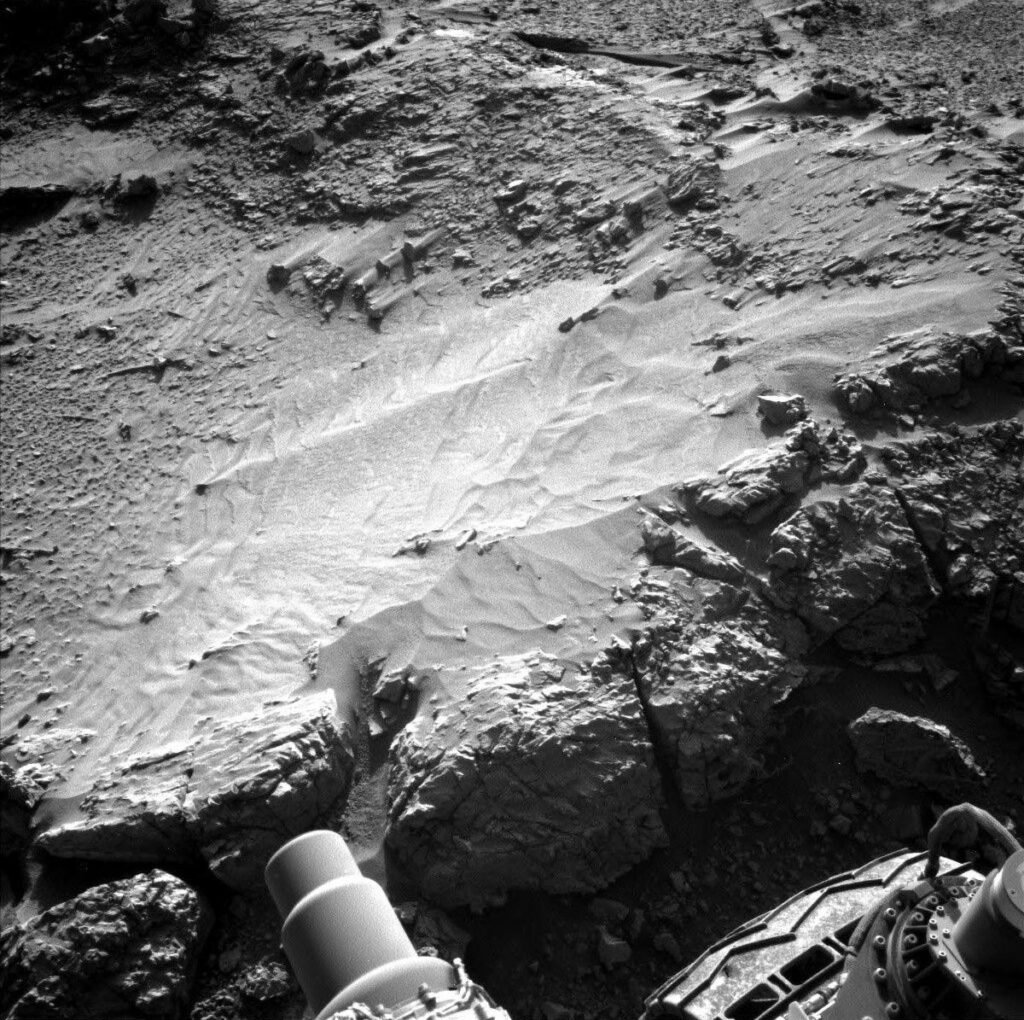
Despite reaching this long-anticipated area, a complication emerged. One of Curiosity’s front wheels had come to rest on a small pebble, creating a potential hazard. Moving the robotic arm while in this position could cause the rover to shift or slip. In response, mission engineers chose to pause all arm-based operations, focusing instead on maximizing remote data collection using the rover’s cameras and sensors.
Imaging the martian web from every angle
To begin the investigation, Curiosity deployed its Mastcam to construct a sweeping panoramic mosaic of the surrounding terrain. This imaging helps scientists analyze elevation changes and structural continuity across the ridge system. Mastcam also revisited the Temblor Range, a ridge the rover had previously crossed, where its wheel tracks remain imprinted in the Martian soil.
Another nearby feature, an elongated trough, received attention as well. Its formation mechanism remains uncertain, and close-range images may help narrow down the possibilities. The AEGIS autonomous targeting system, previously used to guide scientific instruments, was also reactivated to enhance the imaging campaign.
Simultaneously, the ChemCam laser system was aimed at Glendale Peak, a rugged outcrop located along the ridge network. The team hopes that analyzing the chemical composition of this peak will offer clues about the mineral deposits responsible for the web-like patterns. Additional imaging was also directed at Texoli Butte, another formation in the vicinity, to help compare compositional variations across the region.
Safeguarding systems while observing Mars
While scientific observations continued, engineers at NASA’s Jet Propulsion Laboratory (JPL) carried out routine testing of Curiosity’s Heat Rejection System (HRS). This system plays a vital role in the rover’s operations, using a fluid loop to distribute heat from its radioisotope power source, thereby protecting its internal components.
During this mission segment, the backup pump underwent its scheduled monthly check to ensure it remains ready in case the primary pump fails. This maintenance proceeded without interfering with the science schedule. As the rover remained stationary, it allowed the team to efficiently balance system checks with remote exploration.
Preparing for contact with the Martian surface
After completing its imaging objectives, Curiosity is set to perform a slight maneuver — reversing about 30 centimeters (12 inches) — to safely step off the pebble. This repositioning will allow scientists to unstow the robotic arm and potentially place instruments directly onto the surface for in-depth analysis of the ridges and their composition.
This phase of the mission is crucial. A close-up investigation of the suspected boxwork structure could confirm whether groundwater once flowed through these rocks, leaving behind mineral veins that have resisted erosion over time. If validated, this would provide valuable insight into Mars’ past hydrology, possibly indicating a longer or more widespread history of water activity than previously thought.
Watching the sky while probing the ground
In tandem with geological work, the rover continues its atmospheric observations. On the plan’s second sol — when no new terrain is targeted — Curiosity conducts a dust-devil survey, records a Navcam suprahorizon movie, and uses the Mastcam solar tau technique to measure the amount of dust suspended in the atmosphere. These readings contribute to a broader understanding of weather patterns on Mars, while also supporting future mission planning and rover health.
The ChemCam also continues its autonomous operations, selecting new targets for analysis through the AEGIS system as it scans for additional clues in the Martian landscape. Ashley Stroupe, Mission Operations Engineer at JPL, authored the mission report outlining these procedures and next steps in the investigation.